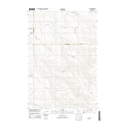
2013 Map of Coppei
USGS Topo · Published 2013About this map
Coppei serves as the primary focal point in this landscape where the Walla Walla Co and Columbia Co boundaries meet. The geography is defined by a dense network of seasonal and perennial drainages, including the branching headwaters of S Fork Coppei Cr and N Fork Coppei Cr. Higher elevations are marked by landmarks like Jasper Mtn, while the valleys are carved by significant hollows such as Dustin Hollow and Bundy Hollow.
Find a feature on this map
33 named features on this map. Tap any name to fly to it.
Don’t see what you’re looking for? This feature index may not catch every label — zoom into the map to look around manually.
Map Details
Editions of this 2013 Coppei Map
This is the sole edition of this map. No revisions or reprints were ever made.
Other maps of this area

1919 · Walla Walla
USGS Topo · 1:125,000

1921 · Walla Walla
USGS Topo · 1:125,000

1937 · Pomeroy
USGS Topo · 1:96,000

1942 · Pomeroy
USGS Topo · 1:125,000

1953 · Walla Walla
USGS Topo · 1:250,000

1955 · Pullman
USGS Topo · 1:250,000

1958 · Pullman
USGS Topo · 1:250,000

1958 · Walla Walla
USGS Topo · 1:250,000

1966 · Dixie
USGS Topo · 1:24,000
1966 · Buroker
USGS Topo · 1:24,000