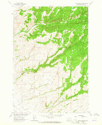
1963 Map of Copper Mountain
USGS Topo · Published 1964About this map
Beaverhead National Forest defines this high-altitude landscape of Madison County, where mountain peaks give way to deep drainages and early industrial development. The 1963 survey records a working landscape shaped by mining and water management, notably the Vigilante Canal following the lower contours. Hard-rock mining history is evident at the Toledo Mine and Smuggler Mine, which sit tucked into the steep slopes above the forest floor.
Find a feature on this map
41 named features on this map. Tap any name to fly to it.
Don’t see what you’re looking for? This feature index may not catch every label — zoom into the map to look around manually.
Map Details
Editions of this 1963 Copper Mountain Map
2 editions found
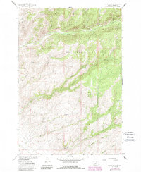
Other maps of this area

1888 · Three Forks
USGS Topo · 1:250,000

1893 · Dillon
USGS Topo · 1:250,000

1894 · Three Forks
USGS Topo · 1:250,000

1895 · Three Forks
USGS Topo · 1:250,000

1947 · Bozeman
USGS Topo · 1:250,000

1948 · Bozeman
USGS Topo · 1:250,000

1950 · Harrison
USGS Topo · 1:62,500

1950 · Virginia City
USGS Topo · 1:62,500

1955 · Bozeman
USGS Topo · 1:250,000

1955 · Dillon
USGS Topo · 1:250,000