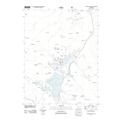
2011 Map of Copper Mountain
USGS Topo · Published 2011About this map
Queen-of-the-West Mine and the Ten Mile Tunnel Mine are among the dense concentration of lode claims and tunnels that define the industrial history of this high-altitude landscape. The map reveals an intricate network of early 21st-century water management and mining infrastructure, including the massive Tenmile Tailings Pond and Robinson Tailings Pond that occupy the valley floor. These features, alongside the Climax-Moly Number 4 Reservoir, indicate the massive scale of 20th-century molybdenum extraction and processing in the Tenmile Range.
Find a feature on this map
99 named features on this map. Tap any name to fly to it.
Don’t see what you’re looking for? This feature index may not catch every label — zoom into the map to look around manually.
Map Details
Editions of this 2011 Copper Mountain Map
This is the sole edition of this map. No revisions or reprints were ever made.
Other maps of this area

1889 · Leadville
USGS Topo · 1:125,000

1891 · Leadville
USGS Topo · 1:125,000

1929 · Dillon
USGS Topo · 1:62,500

1934 · Climax
USGS Topo · 1:48,000

1934 · Minturn
USGS Topo · 1:62,500

1934 · Dillon
USGS Topo · 1:62,500

1938 · Mt. Lincoln
USGS Topo · 1:48,000

1942 · Leadville
USGS Topo · 1:125,000

1945 · Mount Lincoln
USGS Topo · 1:62,500

1949 · Holy Cross
USGS Topo · 1:62,500