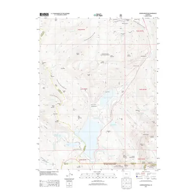
2013 Map of Copper Mountain
USGS Topo · Published 2013About this map
The high alpine intersection of Eagle, Summit, and Lake Counties is defined by the massive industrial and recreational footprints found at these elevations. The Copper Mountain Ski Area dominates the northeast, while the industrial legacy of the Climax mining district is evident in the presence of the Climax-Moly Number 4 Reservoir, Oxide Tailings Pond, and Mayflower Trailings Pond. These features illustrate the intense land use required for high-altitude extraction and tourism.
Find a feature on this map
88 named features on this map. Tap any name to fly to it.
Don’t see what you’re looking for? This feature index may not catch every label — zoom into the map to look around manually.
Map Details
Editions of this 2013 Copper Mountain Map
This is the sole edition of this map. No revisions or reprints were ever made.
Other maps of this area

1889 · Leadville
USGS Topo · 1:125,000

1891 · Leadville
USGS Topo · 1:125,000

1929 · Dillon
USGS Topo · 1:62,500

1934 · Climax
USGS Topo · 1:48,000

1934 · Minturn
USGS Topo · 1:62,500

1934 · Dillon
USGS Topo · 1:62,500

1938 · Mt. Lincoln
USGS Topo · 1:48,000

1942 · Leadville
USGS Topo · 1:125,000

1945 · Mount Lincoln
USGS Topo · 1:62,500

1949 · Holy Cross
USGS Topo · 1:62,500