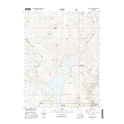
2016 Map of Copper Mountain
USGS Topo · Published 2016About this map
Copper Mountain dominates this high-altitude landscape at the confluence of the White River National Forest, San Isabel National Forest, and Pike National Forest. The 2016 terrain is defined by its industrial water management and recreation infrastructure, following the path of the Continental Divide National Scenic Trail as it winds through Searle Pass and Kokomo Pass. Evidence of the region’s mining history is prominent in the form of the Tenmile Tailings Pond and Oxide Tailings Pond, which contrast with natural water bodies like Robinson Lake and Chalk Lake. The convergence of Eagle, Summit, Lake, and Park counties near Chalk Mountain Reservoir highlights the complex political and geographic boundaries that meet among the peaks of the Tenmile Range.
Find a feature on this map
80 named features on this map. Tap any name to fly to it.
Don’t see what you’re looking for? This feature index may not catch every label — zoom into the map to look around manually.
Map Details
Editions of this 2016 Copper Mountain Map
This is the sole edition of this map. No revisions or reprints were ever made.
Other maps of this area

1889 · Leadville
USGS Topo · 1:125,000

1891 · Leadville
USGS Topo · 1:125,000

1929 · Dillon
USGS Topo · 1:62,500

1934 · Climax
USGS Topo · 1:48,000

1934 · Minturn
USGS Topo · 1:62,500

1934 · Dillon
USGS Topo · 1:62,500

1938 · Mt. Lincoln
USGS Topo · 1:48,000

1942 · Leadville
USGS Topo · 1:125,000

1945 · Mount Lincoln
USGS Topo · 1:62,500

1949 · Holy Cross
USGS Topo · 1:62,500