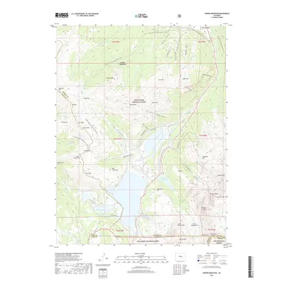
2019 Map of Copper Mountain
USGS Topo · Published 2019About this map
Copper Mountain Ski Area and the massive industrial footprint of Climax dominate this high-elevation landscape at the intersection of the Tenmile Range and the Mosquito Range. The map reveals a complex network of high-altitude water management, including the Clinton Gulch Dam Reservoir, Chalk Mountain Reservoir, and the Columbine Ditch, which redirect snowmelt across the Continental Divide. These engineered water systems sit alongside natural features like Robinson Lake and Chalk Lake, highlighting the century-long effort to support mining and municipal needs in the Rockies.
Find a feature on this map
79 named features on this map. Tap any name to fly to it.
Don’t see what you’re looking for? This feature index may not catch every label — zoom into the map to look around manually.
Map Details
Editions of this 2019 Copper Mountain Map
This is the sole edition of this map. No revisions or reprints were ever made.
Other maps of this area

1889 · Leadville
USGS Topo · 1:125,000

1891 · Leadville
USGS Topo · 1:125,000

1929 · Dillon
USGS Topo · 1:62,500

1934 · Climax
USGS Topo · 1:48,000

1934 · Minturn
USGS Topo · 1:62,500

1934 · Dillon
USGS Topo · 1:62,500

1938 · Mt. Lincoln
USGS Topo · 1:48,000

1942 · Leadville
USGS Topo · 1:125,000

1945 · Mount Lincoln
USGS Topo · 1:62,500

1949 · Holy Cross
USGS Topo · 1:62,500