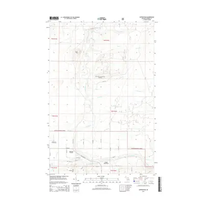
2014 Map of Copper Peak
USGS Topo · Published 2014About this map
Copper Peak and Big Powderhorn Mtn dominate the topography of this portion of Ottawa National Forest, where the terrain of the Upper Peninsula is defined by steep ridges and the drainage of the Black River. This 2014 survey documents the area's transition from the residential and commercial centers of North Bessemer and Auvinen Corner in the south toward the expansive forest lands to the north. The map details a landscape shaped by both recreation and infrastructure, including the N Country National Scenic Trail and the Gogebic-Iron County Airport. Water remains a central feature, with numerous cascades such as Powder Horn Falls, Chippewa Falls, and Algonquin Falls along the river's course. Local family names and early 20th-century history are preserved through road labels like Hedberg Rd, Salmi Ln, and Heikkila Rd, reflecting the Finnish heritage of the Gogebic Range.
Find a feature on this map
51 named features on this map. Tap any name to fly to it.
Don’t see what you’re looking for? This feature index may not catch every label — zoom into the map to look around manually.
Map Details
Editions of this 2014 Copper Peak Map
This is the sole edition of this map. No revisions or reprints were ever made.
Other maps of this area

1943 · Ironwood
USGS Topo · 1:48,000

1953 · Ashland
USGS Topo · 1:250,000

1955 · Ironwood
USGS Topo · 1:24,000

1955 · Bessemer
USGS Topo · 1:24,000

1955 · Wakefield
USGS Topo · 1:24,000

1955 · Wakefield
USGS Topo · 1:62,500

1955 · Ironwood
USGS Topo · 1:62,500

1956 · North Ironwood
USGS Topo · 1:62,500

1956 · Thomaston
USGS Topo · 1:62,500

1958 · Ashland
USGS Topo · 1:250,000