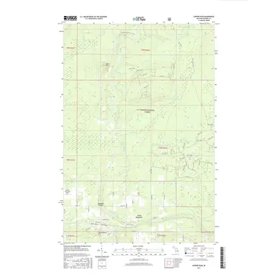
2017 Map of Copper Peak
USGS Topo · Published 2017About this map
Black River dominates this northern Michigan landscape, winding northward through the Ottawa National Forest toward Lake Superior. The terrain is defined by significant elevations and water features, including the prominent Copper Peak and Big Powderhorn Mtn, which signal the region's importance for winter recreation and topography. Along the river’s course, numerous cascades such as Chippewa Falls, Algonquin Falls, and Powder Horn Falls are documented, illustrating the sharp descent of the watershed.
Find a feature on this map
73 named features on this map. Tap any name to fly to it.
Don’t see what you’re looking for? This feature index may not catch every label — zoom into the map to look around manually.
Map Details
Editions of this 2017 Copper Peak Map
This is the sole edition of this map. No revisions or reprints were ever made.
Other maps of this area

1943 · Ironwood
USGS Topo · 1:48,000

1953 · Ashland
USGS Topo · 1:250,000

1955 · Ironwood
USGS Topo · 1:24,000

1955 · Bessemer
USGS Topo · 1:24,000

1955 · Wakefield
USGS Topo · 1:24,000

1955 · Wakefield
USGS Topo · 1:62,500

1955 · Ironwood
USGS Topo · 1:62,500

1956 · North Ironwood
USGS Topo · 1:62,500

1956 · Thomaston
USGS Topo · 1:62,500

1958 · Ashland
USGS Topo · 1:250,000