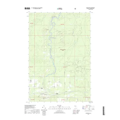
2019 Map of Copper Peak
USGS Topo · Published 2019About this map
The Black Wild and Scenic River carves a deep path through this section of the Ottawa National Forest, defining a landscape where industrial heritage meets modern recreation. Along the southern edge, the residential areas of North Bessemer and Auvinen Corner mark the transition from the city of Bessemer into the highlands. The terrain is punctuated by significant peaks and falls, including the prominent Copper Peak and Big Powderhorn Mtn, alongside natural features like Powder Horn Falls and Rocky Forty Falls. The mapping shows a complex network of forest service roads, such as Nfst-120, and local routes like Black River Rd that connect these remote timberlands. The inclusion of the Gogebic-Iron County Airport and the N Country National Scenic Trail illustrates the diverse use of this Gogebic County terrain, from aviation infrastructure to long-distance wilderness trekking.
Find a feature on this map
72 named features on this map. Tap any name to fly to it.
Don’t see what you’re looking for? This feature index may not catch every label — zoom into the map to look around manually.
Map Details
Editions of this 2019 Copper Peak Map
This is the sole edition of this map. No revisions or reprints were ever made.
Other maps of this area

1943 · Ironwood
USGS Topo · 1:48,000

1953 · Ashland
USGS Topo · 1:250,000

1955 · Ironwood
USGS Topo · 1:24,000

1955 · Bessemer
USGS Topo · 1:24,000

1955 · Wakefield
USGS Topo · 1:24,000

1955 · Wakefield
USGS Topo · 1:62,500

1955 · Ironwood
USGS Topo · 1:62,500

1956 · North Ironwood
USGS Topo · 1:62,500

1956 · Thomaston
USGS Topo · 1:62,500

1958 · Ashland
USGS Topo · 1:250,000