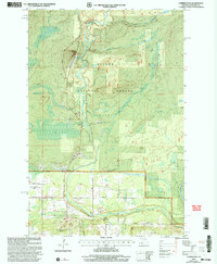
1999 Map of Copper Peak
USGS Topo · Published 2004About this map
The Black River carves a deep path through the Western Upper Peninsula in this survey, showcasing the area's transition from forest wilderness to recreation and transportation hub. The landscape is dominated by the Ottawa National Forest, where the Copper Peak ski flying hill and the Big Powderhorn Ski Area signify the importance of winter sports to the local economy near the Ironwood and Bessemer municipal boundaries. Numerous waterfalls, including Algonquin Falls, Chippewa Falls, and Rocky Rocky Falls, dot the river system, emphasizing the dramatic drops in elevation as the water moves toward Lake Superior.
Find a feature on this map
36 named features on this map. Tap any name to fly to it.
Don’t see what you’re looking for? This feature index may not catch every label — zoom into the map to look around manually.
Map Details
Editions of this 1999 Copper Peak Map
This is the sole edition of this map. No revisions or reprints were ever made.
Other maps of this area

1943 · Ironwood
USGS Topo · 1:48,000

1953 · Ashland
USGS Topo · 1:250,000

1955 · Ironwood
USGS Topo · 1:24,000

1955 · Bessemer
USGS Topo · 1:24,000

1955 · Wakefield
USGS Topo · 1:24,000

1955 · Wakefield
USGS Topo · 1:62,500

1955 · Ironwood
USGS Topo · 1:62,500

1956 · North Ironwood
USGS Topo · 1:62,500

1956 · Thomaston
USGS Topo · 1:62,500

1958 · Ashland
USGS Topo · 1:250,000