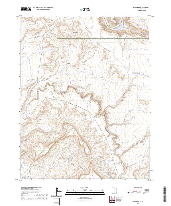
2023 Map of Copper Point
USGS Topo · Published 2023About this map
Glen Canyon National Recreation Area dominates this high-desert landscape in southeastern Utah, where the Colorado River and Lake Powell cut through the red rock of the Colorado Plateau. The terrain is defined by dramatic elevation changes between the flat-topped Wingate Mesa and the deep incisions of Cataract Canyon and Farley Canyon. A network of backcountry routes, including the Fortknocker Canyon Road and Blue Notch Rd, provides access to landmarks like Copper Point and the overlook at Blue Notch. These primitive roads and trails, such as the White Canyon Trl, trace the natural drainage of White Canyon Creek as it winds toward the river. This survey captures the region's managed wilderness character, balancing geological features like Browns Rim and Dry Mesa with the infrastructure of the national recreation area.
Find a feature on this map
28 named features on this map. Tap any name to fly to it.
Don’t see what you’re looking for? This feature index may not catch every label — zoom into the map to look around manually.
Map Details
Editions of this 2023 Copper Point Map
This is the sole edition of this map. No revisions or reprints were ever made.
Other maps of this area

1886 · Henry Mountains
USGS Topo · 1:250,000

1892 · Henry Mountains
USGS Topo · 1:250,000

1952 · Mouth of Dark Canyon
USGS Topo · 1:62,500

1952 · Mancos Mesa
USGS Topo · 1:62,500

1952 · Natural Bridges
USGS Topo · 1:62,500

1952 · Hite
USGS Topo · 1:62,500
1954 · White Canyon 2 NE
USGS Topo · 1:24,000

1954 · White Canyon 3 NW
USGS Topo · 1:24,000

1954 · White Canyon 3 NE
USGS Topo · 1:24,000
1954 · White Canyon 2 SW
USGS Topo · 1:24,000