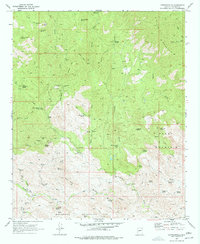
1969 Map of Copperopolis
USGS Topo · Published 1977About this map
The ghost of a mining past lingers at Copperopolis (Site), where this late-1960s survey documents the remnants of Arizona's high-country mineral strikes. Located within the Buckhorn Mountains, the area is defined by a series of significant mining operations, including the Lehman Mill, Copperopolis Mine, and McKenzie Mine. The landscape is a network of rugged peaks such as Lehman Mtn and Black Butte, deeply cut by drainages like Walker Gulch and East Fork Castle Creek. Beyond the industrial footprints, the map reveals isolated structures such as The Rockhouse and scattered graves, hinting at the solitary lives of early prospectors. A maze of Jeep Trails and Wash Trails provides the only access through this complex topography of buttes and canyons.
Find a feature on this map
41 named features on this map. Tap any name to fly to it.
Don’t see what you’re looking for? This feature index may not catch every label — zoom into the map to look around manually.
Map Details
Editions of this 1969 Copperopolis Map
3 editions found
Other maps of this area

1887 · Prescott
USGS Topo · 1:250,000

1892 · Prescott
USGS Topo · 1:250,000

1903 · Bradshaw Mountains
USGS Topo · 1:125,000

1903 · Congress
USGS Topo · 1:125,000

1904 · Congress
USGS Topo · 1:125,000

1947 · Crown King
USGS Topo · 1:62,500

1947 · Wagoner
USGS Topo · 1:62,500

1948 · Crown King
USGS Topo · 1:63,360

1948 · Wagoner
USGS Topo · 1:63,360

1950 · Wagoner
USGS Topo · 1:62,500