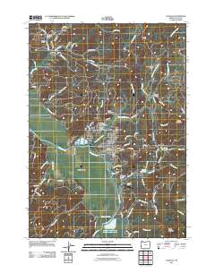
2011 Map of Coquille
USGS Topo · Published 2011About this map
Coquille sits as the central hub of this coastal Oregon landscape, situated along a prominent bend in the Coquille River. The town's layout is well-documented, featuring the Coquille Post Office and nearby cultural landmarks like the Masonic Cemetery and the Independent Order of Odd Fellows Cemetery. To the west, the Coquille Valley opens up, while the surrounding terrain is marked by significant drainage systems including Beaver Creek and Cunningham Creek.
Find a feature on this map
95 named features on this map. Tap any name to fly to it.
Don’t see what you’re looking for? This feature index may not catch every label — zoom into the map to look around manually.
Map Details
Editions of this 2011 Coquille Map
This is the sole edition of this map. No revisions or reprints were ever made.
Other maps of this area

1896 · Coos Bay
USGS Topo · 1:125,000

1898 · Coos Bay
USGS Topo · 1:125,000

1900 · Coos Bay
USGS Topo · 1:125,000

1942 · Empire
USGS Topo · 1:62,500

1942 · Coquille
USGS Topo · 1:62,500

1942 · Coos Bay
USGS Topo · 1:62,500

1943 · Bandon
USGS Topo · 1:62,500

1944 · Empire
USGS Topo · 1:62,500

1944 · Bandon
USGS Topo · 1:62,500

1945 · Coquille
USGS Topo · 1:62,500