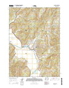
2014 Map of Coquille
USGS Topo · Published 2014About this map
The Coquille River winds through the heart of the Coquille Valley, anchoring a landscape where timber legacy and valley agriculture intersect. In the city of Coquille, the street grid is well-defined, serving as a hub between the river and landmarks like the Masonic Cem and the Independent Order of Odd Fellows Cem. Further south, the Johnson Log Storage and Storing Reservoir indicates the area's continued connection to the logging industry, while the Benham Airport sits on the valley floor. The map tracks the transition from the lowlands of Cedar Point to the surrounding heights of Budd Mtn and Hungry Mtn. Smaller settlements such as Coaledo and Crest Acres are documented alongside water features like Rink Cr Reservoir and Beaver Slough.
Find a feature on this map
96 named features on this map. Tap any name to fly to it.
Don’t see what you’re looking for? This feature index may not catch every label — zoom into the map to look around manually.
Map Details
Editions of this 2014 Coquille Map
This is the sole edition of this map. No revisions or reprints were ever made.
Other maps of this area

1896 · Coos Bay
USGS Topo · 1:125,000

1898 · Coos Bay
USGS Topo · 1:125,000

1900 · Coos Bay
USGS Topo · 1:125,000

1942 · Empire
USGS Topo · 1:62,500

1942 · Coquille
USGS Topo · 1:62,500

1942 · Coos Bay
USGS Topo · 1:62,500

1943 · Bandon
USGS Topo · 1:62,500

1944 · Empire
USGS Topo · 1:62,500

1944 · Bandon
USGS Topo · 1:62,500

1945 · Coquille
USGS Topo · 1:62,500