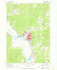
1971 Map of Coquille
USGS Topo · Published 1973About this map
The Coquille River winds through this coastal valley, anchoring a landscape where the river economy and timber interests intersect. In the early 1970s, Coquille serves as a concentrated hub of activity, featuring the High Sch, Lincoln Sch, and several local parks like Sturdivant Park and Washington Sq. The town's industrial and logistical infrastructure is visible through the Sewage Disposal plant, a Radio Tower (KWRO), and the Southern Pacific rail line that parallels the river's path. North of the main settlement, the land rises toward Noble Hill, where the Overland Mine and various borrow pits suggest an active resource extraction history. This survey captures the transition from the developed riverfront to the managed slopes of the Coos County Forest, illustrating how local topography dictated the placement of small outposts like Coaledo and Noble.
Find a feature on this map
63 named features on this map. Tap any name to fly to it.
Don’t see what you’re looking for? This feature index may not catch every label — zoom into the map to look around manually.
Map Details
Editions of this 1971 Coquille Map
This is the sole edition of this map. No revisions or reprints were ever made.
Other maps of this area

1896 · Coos Bay
USGS Topo · 1:125,000

1898 · Coos Bay
USGS Topo · 1:125,000

1900 · Coos Bay
USGS Topo · 1:125,000

1942 · Empire
USGS Topo · 1:62,500

1942 · Coquille
USGS Topo · 1:62,500

1942 · Coos Bay
USGS Topo · 1:62,500

1943 · Bandon
USGS Topo · 1:62,500

1944 · Empire
USGS Topo · 1:62,500

1944 · Bandon
USGS Topo · 1:62,500

1945 · Coquille
USGS Topo · 1:62,500