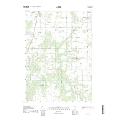
2023 Map of Coral
USGS Topo · Published 2023About this map
The unincorporated community of Coral and the village of Pierson anchor this portion of the West Michigan landscape along the border of Montcalm and Kent counties. The area is defined by a dense network of water features and drainage systems, including the Lovett and Cody Drain, Rice Creek, and several small bodies of water like Coady Lake and Picnic Lake. For genealogists, the map identifies three distinct burial grounds: Coral Cem, Coady Cem, and Saint Marys Cem, providing precise locations for family research. One of the most significant modern landmarks is the Fred Meijer White Pine Trail State Park Trail, which follows the corridor of a former railroad line, demonstrating how historical transit routes have been repurposed for contemporary recreation while maintaining the original survey alignment through the townships.
Find a feature on this map
47 named features on this map. Tap any name to fly to it.
Don’t see what you’re looking for? This feature index may not catch every label — zoom into the map to look around manually.
Map Details
Editions of this 2023 Coral Map
This is the sole edition of this map. No revisions or reprints were ever made.
Other maps of this area

1918 · Cedar Springs
USGS Topo · 1:62,500

1943 · Cedar Springs
USGS Topo · 1:62,500

1954 · Midland
USGS Topo · 1:250,000

1958 · Midland
USGS Topo · 1:250,000

1958 · Sand Lake
USGS Topo · 1:62,500

1959 · Midland
USGS Topo · 1:250,000

1959 · Howard City
USGS Topo · 1:62,500

1966 · Midland
USGS Topo · 1:250,000

1967 · Cedar Springs
USGS Topo · 1:24,000

1972 · Greenville West
USGS Topo · 1:24,000