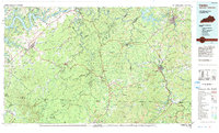
1981 Map of Corbin
USGS Topo · Published 1984About this map
The Cumberland River and its sprawling waters at Lake Cumberland define the northern reaches of this topographic landscape as it stood in the early 1980s. This survey captures a moment of established transit and settlement, with the L & N RR and Cincinnati New Orleans and Texas Pacific RR lines carving through the ridgelines near Corbin and Whitley City. The map reveals the intricate network of the Daniel Boone National Forest, where high ridges like Pine Mountain and Curd Garden Ridge separate numerous small communities such as Marshes Siding and Stearns. From the bustling corridors along I-75 to the more secluded valleys of Jellico Creek and Rock Creek, the sheet provides a detailed look at the rural industry and highland settlements along the Kentucky and Tennessee border.
Find a feature on this map
136 named features on this map. Tap any name to fly to it.
Don’t see what you’re looking for? This feature index may not catch every label — zoom into the map to look around manually.
Map Details
Editions of this 1981 Corbin Map
This is the sole edition of this map. No revisions or reprints were ever made.
Other maps of this area

1886 · Cumberland Gap
USGS Topo · 1:125,000

1888 · Cumberland Gap
USGS Topo · 1:125,000

1890 · Williamsburg
USGS Topo · 1:125,000

1891 · Manchester
USGS Topo · 1:125,000

1891 · Cumberland Gap
USGS Topo · 1:125,000

1893 · London
USGS Topo · 1:125,000

1893 · Briceville
USGS Topo · 1:125,000

1894 · Williamsburg
USGS Topo · 1:125,000

1895 · Wartburg
USGS Topo · 1:125,000

1895 · Briceville
USGS Topo · 1:125,000