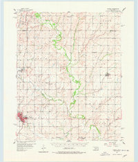
1956 Map of Cordell
USGS Topo · Published 1978About this map
Cordell serves as the central hub of this Washita County landscape, where the St Louis and San Francisco railroad cuts through the western terrain to connect the settlements of Bessie and Cordell. The map reveals a deeply rooted rural community defined by its numerous denominational landmarks, such as Bergthal Ch, Peace Ch, and Herold Ch, alongside several family and community burial grounds like Krimmer Cem and Sichar Cem. The meandering path of the Washita River dominates the central valley, joined by tributaries including Boggy Creek and Coffee Creek. Modernity and tradition meet at the town edges, where the Cordell Airport and a Radio Tower sit in contrast to the Chapel Hill Sch (Abandoned). The arrangement of these small schools and churches suggests a mid-century period of transition for these agricultural townships.
Find a feature on this map
45 named features on this map. Tap any name to fly to it.
Don’t see what you’re looking for? This feature index may not catch every label — zoom into the map to look around manually.
Map Details
Editions of this 1956 Cordell Map
2 editions found
Other maps of this area

1955 · Clinton
USGS Topo · 1:250,000

1956 · Cordell
USGS Topo · 1:62,500

1957 · Clinton
USGS Topo · 1:250,000

1957 · Butler
USGS Topo · 1:62,500

1957 · Clinton
USGS Topo · 1:62,500

1957 · Dill City
USGS Topo · 1:62,500

1961 · Gotebo
USGS Topo · 1:62,500

1961 · Eakly
USGS Topo · 1:62,500

1961 · Hobart
USGS Topo · 1:62,500

1961 · Carnegie
USGS Topo · 1:62,500