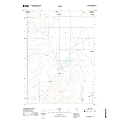
2018 Map of Cordero Mine
USGS Topo · Published 2018About this map
The Cordero Mine serves as a focal point for this high-desert landscape situated on the border of Nevada and Oregon. This 2018 survey reveals the industrial infrastructure of the Cordero settlement and its namesake mining operations, which are deeply integrated with the local geography south of the state line. The map illustrates how drainage systems like McDermitt Cr and Washburn Cr transition from higher elevations into the broad expanse of the Quinn River Valley.
Find a feature on this map
26 named features on this map. Tap any name to fly to it.
Don’t see what you’re looking for? This feature index may not catch every label — zoom into the map to look around manually.
Map Details
Editions of this 2018 Cordero Mine Map
This is the sole edition of this map. No revisions or reprints were ever made.
Other maps of this area

1882 · Paradise
USGS Topo · 1:250,000

1893 · Paradise
USGS Topo · 1:250,000

1955 · McDermitt
USGS Topo · 1:250,000

1955 · Jordan Valley
USGS Topo · 1:250,000

1957 · Jordan Valley
USGS Topo · 1:250,000

1958 · Jordan Valley
USGS Topo · 1:250,000

1959 · McDermitt
USGS Topo · 1:250,000

1959 · McDermitt
USGS Topo · 1:62,500

1959 · Jordan Meadow
USGS Topo · 1:62,500
1982 · Tenmile Ranch
USGS Topo · 1:24,000