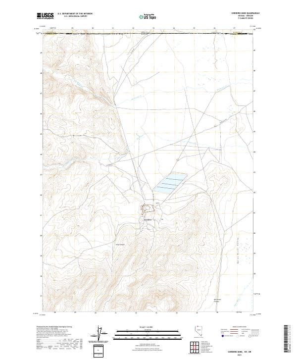
2021 Map of Cordero Mine
USGS Topo · Published 2021About this map
The borderlands between Humboldt County, Nevada, and Malheur County, Oregon, are defined by an arid basin landscape where the northern edge of the Quinn River Valley meets the high desert plateaus. At the heart of this 2021 survey sits the mining community of Cordero, situated along State Hwy 793. The map details the transition from the relatively flat valley floor, drained by the Quinn River and McDermitt Cr, to the more complex topography of the south, where Long Canyon and McConnell Canyon cut through the rising terrain. Transportation in this high-desert environment relies on a network of functional routes including Cordero Rd and Co Line Rd, reflecting the area's ongoing industrial and mining significance near the state line.
Find a feature on this map
13 named features on this map. Tap any name to fly to it.
Don’t see what you’re looking for? This feature index may not catch every label — zoom into the map to look around manually.
Map Details
Editions of this 2021 Cordero Mine Map
This is the sole edition of this map. No revisions or reprints were ever made.
Other maps of this area

1882 · Paradise
USGS Topo · 1:250,000

1893 · Paradise
USGS Topo · 1:250,000

1955 · McDermitt
USGS Topo · 1:250,000

1955 · Jordan Valley
USGS Topo · 1:250,000

1957 · Jordan Valley
USGS Topo · 1:250,000

1958 · Jordan Valley
USGS Topo · 1:250,000

1959 · McDermitt
USGS Topo · 1:250,000

1959 · McDermitt
USGS Topo · 1:62,500

1959 · Jordan Meadow
USGS Topo · 1:62,500
1982 · Tenmile Ranch
USGS Topo · 1:24,000