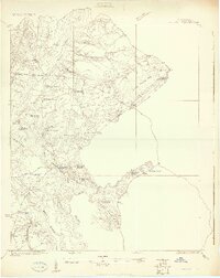
1919 Map of Cordesville
USGS Topo · Published 1919About this map
The Cooper River Lowcountry unfolds in this 1919 survey, illustrating a landscape defined by tidewater reaches and timber infrastructure. The confluence of the East Branch Cooper River and West Branch Cooper River serves as the focal point for riverine commerce at Strawberry Landing and Cedar Hill Landing. The ecclesiastical history of the region is well-represented, with numerous houses of worship including Strawberry Chapel, Grace Chapel, and the uniquely named Promised Land Church situated near Kittridge Crossroads.
Find a feature on this map
52 named features on this map. Tap any name to fly to it.
Don’t see what you’re looking for? This feature index may not catch every label — zoom into the map to look around manually.
Map Details
Editions of this 1919 Cordesville Map
2 editions found
Other maps of this area

1919 · Ladson
USGS Topo · 1:21,120

1919 · Summerville
USGS Topo · 1:48,000

1919 · Wando
USGS Topo · 1:21,120

1919 · Cordesville
USGS Topo · 1:48,000

1919 · Melgrove
USGS Topo · 1:21,120

1919 · Sewee Bay
USGS Topo · 1:21,120

1920 · Chicora
USGS Topo · 1:48,000

1920 · Ravenels
USGS Topo · 1:62,500

1920 · Summerville
USGS Topo · 1:62,500

1921 · Chicora
USGS Topo · 1:62,500