
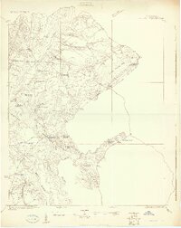
1919 Map of Cordesville
USGS Topo · Published 1919About this map
Bethera and the surrounding Berkeley County lowlands appear in this survey as a landscape defined by expansive wetlands and a network of parish churches. The topography is dominated by the vast Little Hellhole Bay and Peafield Swamp, with settlement patterns clustered around river landings and religious centers. Numerous historic congregations are documented here, including Strawberry Chapel, Pompein Chapel, and St Lukes Church, highlighting the area's deep-rooted community structure at the start of the twentieth century.
Find a feature on this map
42 named features on this map. Tap any name to fly to it.
Don’t see what you’re looking for? This feature index may not catch every label — zoom into the map to look around manually.
Map Details
Editions of this 1919 Cordesville Map
2 editions found
Other maps of this area

1919 · Ladson
USGS Topo · 1:21,120

1919 · Summerville
USGS Topo · 1:48,000

1919 · Wando
USGS Topo · 1:21,120

1919 · Melgrove
USGS Topo · 1:21,120

1919 · Sewee Bay
USGS Topo · 1:21,120

1920 · Chicora
USGS Topo · 1:48,000

1920 · Ravenels
USGS Topo · 1:62,500

1920 · Summerville
USGS Topo · 1:62,500

1921 · Chicora
USGS Topo · 1:62,500

1940 · Melgrove
USGS Topo · 1:24,000