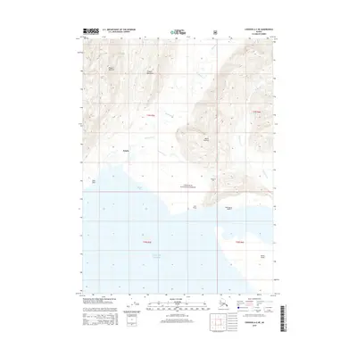
2014 Map of Cordova A-2 NE
USGS Topo · Published 2014About this map
The settlement of Katalla sits at the edge of the Gulf of Alaska, marking a site of significant early industrial history. This area within the Chugach National Forest is dominated by the steep slopes of Ragged Mountain and Mount Hazelet, which overlook the complex drainage system of the Katalla River, Clear Cr, and Katalla Slough. The coastal geography is defined by prominent landmarks such as Palm Point and Strawberry Point, which frame the entrance to Katalla Bay.
Find a feature on this map
22 named features on this map. Tap any name to fly to it.
Don’t see what you’re looking for? This feature index may not catch every label — zoom into the map to look around manually.
Map Details
Editions of this 2014 Cordova A-2 NE Map
This is the sole edition of this map. No revisions or reprints were ever made.
Other maps of this area

1948 · Cordova
USGS Topo · 1:250,000

1950 · Cordova B-2
USGS Topo · 1:63,360

1950 · Cordova A-1
USGS Topo · 1:63,360

1950 · Cordova A-2
USGS Topo · 1:63,360

1951 · Cordova
USGS Topo · 1:250,000

1951 · Cordova B-1
USGS Topo · 1:63,360

1953 · Cordova A-2
USGS Topo · 1:63,360

1953 · Cordova B-1
USGS Topo · 1:63,360

1953 · Cordova B-2
USGS Topo · 1:63,360
1953 · Cordova A-1
USGS Topo · 1:63,360