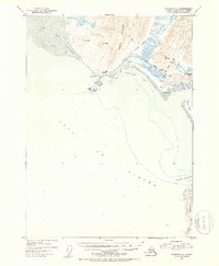
1953 Map of Cordova A-2
USGS Topo · Published 1954About this map
The Katalla Oil Field (Inactive) and the remains of Alaska's early petroleum industry anchor this coastal survey. Following the initial discovery of oil at the turn of the century, the settlement of Katalla served as a key industrial hub until natural forces and economic shifts led to its decline. The map records the infrastructure of this era, including a Refinery (Aban'd) and an Old Railroad Grade that skirts the base of Ragged Mountain.
Find a feature on this map
36 named features on this map. Tap any name to fly to it.
Don’t see what you’re looking for? This feature index may not catch every label — zoom into the map to look around manually.
Map Details
Editions of this 1953 Cordova A-2 Map
2 editions found
Other maps of this area

1948 · Cordova
USGS Topo · 1:250,000

1948 · Middleton Island
USGS Topo · 1:250,000

1950 · Middleton Island
USGS Topo · 1:250,000

1950 · Cordova B-2
USGS Topo · 1:63,360

1950 · Cordova A-1
USGS Topo · 1:63,360

1950 · Cordova A-2
USGS Topo · 1:63,360

1951 · Cordova
USGS Topo · 1:250,000

1951 · Cordova B-1
USGS Topo · 1:63,360

1952 · Cordova B-3
USGS Topo · 1:63,360

1953 · Cordova A-2
USGS Topo · 1:63,360