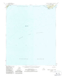
1988 Map of Cordova A-7 and A-8
USGS Topo · Published 1988About this map
Cape Hinchinbrook serves as the focal point of this maritime survey, marking the southwestern tip of Hinchinbrook Island where it meets the waters of the Gulf of Alaska. The site contains the Hinchinbrook Lighthouse Reserve, a critical navigational hub featuring a Lighthouse, Radio Tower, and Heliport to support coastal operations. The surrounding waters are defined by the Hinchinbrook Entrance, a deep passage leading from the Pacific Ocean toward the inner sounds. Most of the landmass shown falls within the Chugach Nat For, reflecting the federal management of this coastal frontier. To the west, the tip of Montague Island is visible, while the isolated Seal Rocks emerge from the sea as a distinct maritime hazard or landmark. The map documents the bathymetry and shoreline as they were understood following updates in the early 1980s.
Find a feature on this map
13 named features on this map. Tap any name to fly to it.
Don’t see what you’re looking for? This feature index may not catch every label — zoom into the map to look around manually.
Map Details
Editions of this 1988 Cordova A-7 and A-8 Map
This is the sole edition of this map. No revisions or reprints were ever made.
Other maps of this area

1946 · Blying Sound
USGS Topo · 1:250,000

1948 · Cordova
USGS Topo · 1:250,000

1948 · Middleton Island
USGS Topo · 1:250,000

1950 · Middleton Island
USGS Topo · 1:250,000

1950 · Cordova B-7
USGS Topo · 1:63,360

1951 · Blying Sound
USGS Topo · 1:250,000

1951 · Seward
USGS Topo · 1:250,000

1951 · Cordova
USGS Topo · 1:250,000

1951 · Seward B-1
USGS Topo · 1:63,360

1951 · Seward A-1
USGS Topo · 1:63,360