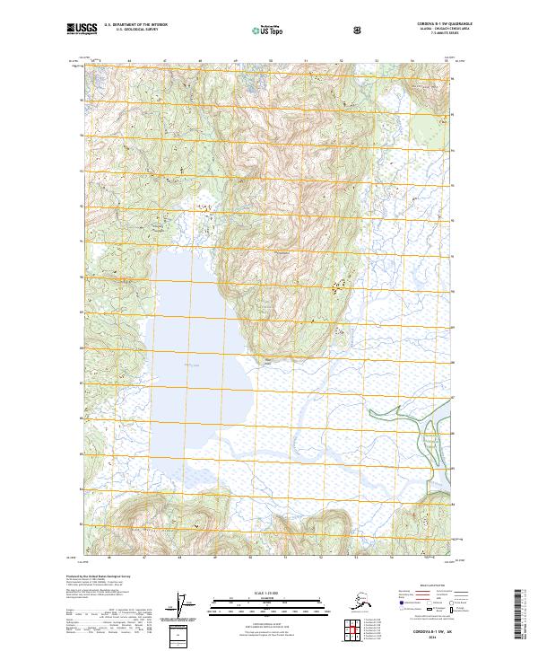
2024 Map of Cordova B-1 SW
USGS Topo · Published 2024About this map
Bering Lake dominates this coastal landscape where the glacial waters of the Bering River meet the intricate drainage systems of the Chugach National Forest. The map detail reveals an environment of dramatic relief, with the Chugach Mountains and high points like Mt Hamilton and Kushtaka Mtn overlooking a complex network of waterways. Watercourses such as Shepherd Creek and Powers Creek cut through the terrain, illustrating the active hydrologic processes of this remote Alaskan region. To the south, the Don Miller Hills rise above the coastal flats, while Poul Point provides a distinct geographical marker along the lake shore. This 2024 survey documents a wilderness primarily defined by its natural features, with no major road networks or settlements, reflecting the preserved character of the national forest land.
Find a feature on this map
21 named features on this map. Tap any name to fly to it.
Don’t see what you’re looking for? This feature index may not catch every label — zoom into the map to look around manually.
Map Details
Editions of this 2024 Cordova B-1 SW Map
This is the sole edition of this map. No revisions or reprints were ever made.
Other maps of this area

1948 · Cordova
USGS Topo · 1:250,000

1950 · Cordova B-2
USGS Topo · 1:63,360

1950 · Cordova A-1
USGS Topo · 1:63,360

1950 · Cordova A-2
USGS Topo · 1:63,360

1951 · Cordova
USGS Topo · 1:250,000

1951 · Cordova B-1
USGS Topo · 1:63,360

1953 · Cordova A-2
USGS Topo · 1:63,360

1953 · Cordova B-1
USGS Topo · 1:63,360

1953 · Cordova B-2
USGS Topo · 1:63,360
1953 · Cordova A-1
USGS Topo · 1:63,360