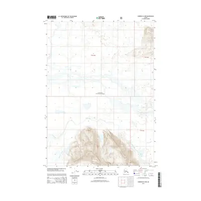
2014 Map of Cordova B-2 NW
USGS Topo · Published 2014About this map
The glacial waters of the Martin River dominate this coastal Alaskan landscape, carving a complex network of channels and the Martin River Slough as it flows through the Chugach National Forest. The 2014 survey reveals the dynamic hydrology of the region, where the broad river basin meets the foothills, creating prominent water bodies like Martin Lake. In the northern portion of the quadrangle, Sheep Cr winds through the drainage basin, reflecting the intricate natural irrigation of this roadless wilderness. The map provides a detailed view of the Public Land Survey System divisions, including t16s r4e and t17s r5e, which organize this portion of the Unorganized Borough for administrative and conservation purposes.
Find a feature on this map
9 named features on this map. Tap any name to fly to it.
Don’t see what you’re looking for? This feature index may not catch every label — zoom into the map to look around manually.
Map Details
Editions of this 2014 Cordova B-2 NW Map
This is the sole edition of this map. No revisions or reprints were ever made.
Other maps of this area

1948 · Cordova
USGS Topo · 1:250,000

1950 · Cordova B-2
USGS Topo · 1:63,360

1951 · Cordova
USGS Topo · 1:250,000

1951 · Cordova C-3
USGS Topo · 1:63,360

1952 · Cordova B-3
USGS Topo · 1:63,360

1953 · Cordova C-3
USGS Topo · 1:63,360

1953 · Cordova B-2
USGS Topo · 1:63,360

1953 · Cordova B-3
USGS Topo · 1:63,360

1959 · Cordova C-2
USGS Topo · 1:63,360

1959 · Cordova
USGS Topo · 1:250,000