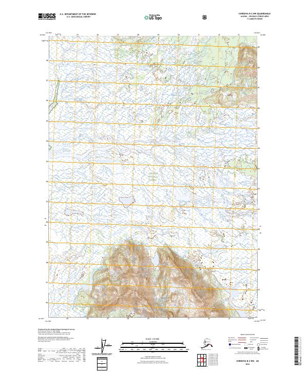
2024 Map of Cordova B-2 NW
USGS Topo · Published 2024About this map
Chugach National Forest land dominates this remote corner of the Copper River Delta region, where the steep elevation of Ragged Mtn rises sharply out of the lowland marshes. The landscape is defined by the complex aquatic systems of the Martin River and its intricate secondary channels, such as the Martin River Slough. These waterways navigate through a vast expanse of wetlands, which represent the transition from mountainous coastal terrain to the tidal influence of the gulf. Along the southeastern edge of the quadrangle, Martin Lake sits at the base of the mountains, acting as a natural catch basin for glacial runoff and snowmelt. This topographic study captures a wilderness largely devoid of human infrastructure, illustrating the raw geological and hydrological processes of the Alaska coast in the early 21st century.
Find a feature on this map
9 named features on this map. Tap any name to fly to it.
Don’t see what you’re looking for? This feature index may not catch every label — zoom into the map to look around manually.
Map Details
Editions of this 2024 Cordova B-2 NW Map
This is the sole edition of this map. No revisions or reprints were ever made.
Other maps of this area

1948 · Cordova
USGS Topo · 1:250,000

1950 · Cordova B-2
USGS Topo · 1:63,360

1951 · Cordova
USGS Topo · 1:250,000

1951 · Cordova C-3
USGS Topo · 1:63,360

1952 · Cordova B-3
USGS Topo · 1:63,360

1953 · Cordova C-3
USGS Topo · 1:63,360

1953 · Cordova B-2
USGS Topo · 1:63,360

1953 · Cordova B-3
USGS Topo · 1:63,360

1959 · Cordova C-2
USGS Topo · 1:63,360

1959 · Cordova
USGS Topo · 1:250,000