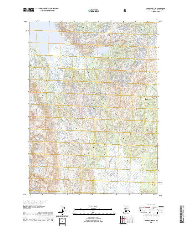
2024 Map of Cordova B-2 SE
USGS Topo · Published 2024About this map
Chugach National Forest encompasses the entirety of this coastal Alaskan landscape, where the steep rises of Ragged Mtn drop toward the low-lying wetlands of the Copper River Delta region. The map captures a wilderness defined by water and high relief, with the eastern expanse of Martin Lake serving as a primary landmark in the northwest corner. This area is shaped by a intricate network of drainage, where Clear Creek and the Katalla River wind through narrow valleys and broad marshes toward the Gulf of Alaska. The dense contour lines along the western edge illustrate the abrupt verticality of the terrain, contrasting sharply with the saturated plains to the east. This 2024 edition provides an updated topographic view of an area that remains largely roadless and primitive, preserving the natural character of the Alaskan coast.
Find a feature on this map
11 named features on this map. Tap any name to fly to it.
Don’t see what you’re looking for? This feature index may not catch every label — zoom into the map to look around manually.
Map Details
Editions of this 2024 Cordova B-2 SE Map
This is the sole edition of this map. No revisions or reprints were ever made.
Other maps of this area

1948 · Cordova
USGS Topo · 1:250,000

1950 · Cordova B-2
USGS Topo · 1:63,360

1950 · Cordova A-1
USGS Topo · 1:63,360

1950 · Cordova A-2
USGS Topo · 1:63,360

1951 · Cordova
USGS Topo · 1:250,000

1951 · Cordova B-1
USGS Topo · 1:63,360

1953 · Cordova A-2
USGS Topo · 1:63,360

1953 · Cordova B-1
USGS Topo · 1:63,360

1953 · Cordova B-2
USGS Topo · 1:63,360
1953 · Cordova A-1
USGS Topo · 1:63,360