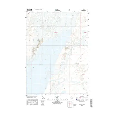
2014 Map of Cordova B-3 NE
USGS Topo · Published 2014About this map
The Copper River Hwy cuts across the northern edge of this coastal landscape where the Copper River delta meets the Gulf of Alaska. In this complex riverine environment, numerous braided channels like Hotcake Channel and small streams such as Sheep Cr wind through shifting silts and low-lying landforms. Much of the eastern portion of the map is protected within the Chugach National Forest, illustrating the transition from managed forest wilderness to the open sea. Named land features such as Heart Island and Long Island rise above the delta's watery network, providing stable landmarks in an otherwise fluid terrain. To the south, the Martin River flows toward the coast, completing a picture of a massive glacial drainage system at its terminus.
Find a feature on this map
13 named features on this map. Tap any name to fly to it.
Don’t see what you’re looking for? This feature index may not catch every label — zoom into the map to look around manually.
Map Details
Editions of this 2014 Cordova B-3 NE Map
This is the sole edition of this map. No revisions or reprints were ever made.
Other maps of this area

1948 · Cordova
USGS Topo · 1:250,000

1950 · Cordova B-2
USGS Topo · 1:63,360

1951 · Cordova
USGS Topo · 1:250,000

1951 · Cordova C-3
USGS Topo · 1:63,360

1952 · Cordova B-3
USGS Topo · 1:63,360

1953 · Cordova C-3
USGS Topo · 1:63,360

1953 · Cordova B-2
USGS Topo · 1:63,360

1953 · Cordova B-3
USGS Topo · 1:63,360

1959 · Cordova C-2
USGS Topo · 1:63,360

1959 · Cordova
USGS Topo · 1:250,000