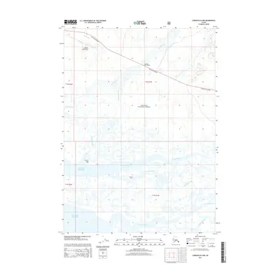
2014 Map of Cordova B-4 NW
USGS Topo · Published 2014About this map
Merle K (Mudhole) Smith Airport anchors the northwestern corner of this coastal Alaskan landscape, where the terrestrial environment meets the Gulf of Alaska. The terrain is defined by a dense network of braided glacial runoff and tidal channels, notably the Sheridan River, Glacier River, and Alaganik Slough. The Copper River Highway cuts a lone path across the northern reaches, crossing the Sheridan River Bridge before disappearing toward the eastern horizon.
Find a feature on this map
17 named features on this map. Tap any name to fly to it.
Don’t see what you’re looking for? This feature index may not catch every label — zoom into the map to look around manually.
Map Details
Editions of this 2014 Cordova B-4 NW Map
This is the sole edition of this map. No revisions or reprints were ever made.
Other maps of this area

1948 · Cordova
USGS Topo · 1:250,000

1950 · Cordova C-4
USGS Topo · 1:63,360

1951 · Cordova
USGS Topo · 1:250,000

1951 · Cordova B-4
USGS Topo · 1:63,360

1951 · Cordova C-5
USGS Topo · 1:63,360

1951 · Cordova B-5
USGS Topo · 1:63,360

1953 · Cordova B-5
USGS Topo · 1:63,360

1953 · Cordova C-4
USGS Topo · 1:63,360

1953 · Cordova C-5
USGS Topo · 1:63,360

1959 · Cordova
USGS Topo · 1:250,000