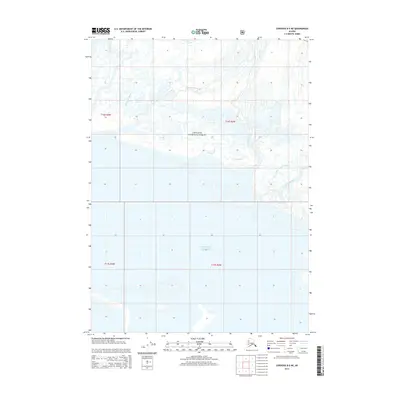
2014 Map of Cordova B-5 NE
USGS Topo · Published 2014About this map
Chugach National Forest encompasses the northern portion of this coastal landscape, where glacial runoff and braided river systems meet the sea. The terrain is defined by a complex network of waterways, including Government Slough and Joe Reeves Slough, which weave through the marshy lowlands at the edge of the Gulf of Alaska. The presence of Big Glacier and its associated Little Glacier Slough indicates an environment shaped by active ice movement and deposition. These glacial outflows feed directly into the Sheridan River and Scott River, creating a dynamic hydrologic system that changes as sediments shift. The absence of roads or permanent structures reflects the wilderness character of this region, governed by the natural cycles of the Eyak River and the tides of the open gulf.
Find a feature on this map
14 named features on this map. Tap any name to fly to it.
Don’t see what you’re looking for? This feature index may not catch every label — zoom into the map to look around manually.
Map Details
Editions of this 2014 Cordova B-5 NE Map
This is the sole edition of this map. No revisions or reprints were ever made.
Other maps of this area

1948 · Cordova
USGS Topo · 1:250,000

1950 · Cordova C-4
USGS Topo · 1:63,360

1951 · Cordova
USGS Topo · 1:250,000

1951 · Cordova B-4
USGS Topo · 1:63,360

1951 · Cordova C-5
USGS Topo · 1:63,360

1951 · Cordova B-5
USGS Topo · 1:63,360

1953 · Cordova B-5
USGS Topo · 1:63,360

1953 · Cordova C-4
USGS Topo · 1:63,360

1953 · Cordova C-5
USGS Topo · 1:63,360

1959 · Cordova
USGS Topo · 1:250,000