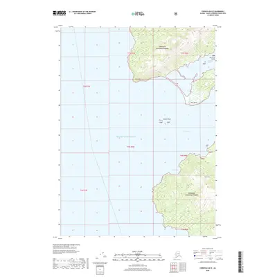
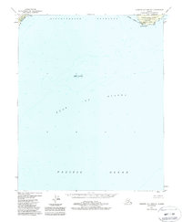
2018 Map of Cordova B-8 SE
USGS Topo · Published 2018About this map
Prince William Sound defines this coastal landscape, where the tides of Port Etches meet the southern reaches of Hinchinbrook Island. The terrain is dominated by the elevations of the Chugach National Forest, featuring the prominent peak of Signal Mtn. Along the intricate shoreline, maritime features provide key navigation points, from the sheltered waters of Constantine Harbor to the exposed Porpoise Rocks and the southern protrusion of Bear Cape. This 2018 survey illustrates the relationship between the deep inlets like English Bay and the surrounding wilderness, documenting the coastal geometry of Bocherov Island and Point Barber as they appeared in the early 21st century.
Find a feature on this map
18 named features on this map. Tap any name to fly to it.
Don’t see what you’re looking for? This feature index may not catch every label — zoom into the map to look around manually.
Map Details
Editions of this 2018 Cordova B-8 SE Map
This is the sole edition of this map. No revisions or reprints were ever made.
Other maps of this area

1948 · Cordova
USGS Topo · 1:250,000

1950 · Cordova B-7
USGS Topo · 1:63,360

1951 · Cordova
USGS Topo · 1:250,000

1951 · Cordova B-8
USGS Topo · 1:63,360
1951 · Cordova A-7 and A-8
USGS Topo · 1:63,360

1953 · Cordova B-7
USGS Topo · 1:63,360
1953 · Cordova B-8
USGS Topo · 1:63,360
1953 · Cordova A-7 and A-8
USGS Topo · 1:63,360

1959 · Cordova
USGS Topo · 1:250,000
1988 · Cordova A-7 and A-8
USGS Topo · 1:63,360