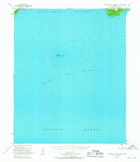
1951 Map of Cordova A-7 and A-8
USGS Topo · Published 1967About this map
Cape Hinchinbrook anchors this coastal survey, where the rugged southern tip of Hinchinbrook Island meets the open waters of the Gulf of Alaska. Mapping the vital navigational approach to Prince William Sound, the sheet details the Hinchinbrook Lighthouse Reserve, a critical outpost featuring a Lighthouse and a Radio Tower atop the cliffs. These installations guarded the western edge of Hinchinbrook Entrance, a deep-water passage between the island and the northeastern tip of Montague Island.
Find a feature on this map
10 named features on this map. Tap any name to fly to it.
Don’t see what you’re looking for? This feature index may not catch every label — zoom into the map to look around manually.
Map Details
Editions of this 1951 Cordova A-7 and A-8 Map
2 editions found
Other maps of this area

1946 · Blying Sound
USGS Topo · 1:250,000

1948 · Cordova
USGS Topo · 1:250,000

1948 · Middleton Island
USGS Topo · 1:250,000

1950 · Middleton Island
USGS Topo · 1:250,000

1950 · Cordova B-7
USGS Topo · 1:63,360

1951 · Blying Sound
USGS Topo · 1:250,000

1951 · Seward
USGS Topo · 1:250,000

1951 · Cordova
USGS Topo · 1:250,000

1951 · Seward B-1
USGS Topo · 1:63,360

1951 · Seward A-1
USGS Topo · 1:63,360