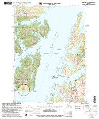
2000 Map of Seward B-3
USGS Topo · Published 2002About this map
Chenega Island and the rugged shoreline of western Prince William Sound define this coastal landscape, revised to reflect conditions at the turn of the millennium. The map documents the Chenega (Site) and a nearby Village at the foot of Chenega Peak, marking a significant location for local history and genealogy. The maritime character of the region is evident in the Marine Highway (Summer Route) cutting through Knight Island Passage, connecting isolated points like Port Audrey and various Cannery locations.
Find a feature on this map
95 named features on this map. Tap any name to fly to it.
Don’t see what you’re looking for? This feature index may not catch every label — zoom into the map to look around manually.
Map Details
Editions of this 2000 Seward B-3 Map
This is the sole edition of this map. No revisions or reprints were ever made.
Other maps of this area

1950 · Seward B-3
USGS Topo · 1:63,360

1951 · Seward
USGS Topo · 1:250,000

1951 · Seward A-2
USGS Topo · 1:63,360

1951 · Seward B-4
USGS Topo · 1:63,360

1951 · Seward A-3
USGS Topo · 1:63,360

1951 · Seward A-4
USGS Topo · 1:63,360

1951 · Seward B-2
USGS Topo · 1:63,360

1951 · Seward C-4
USGS Topo · 1:63,360

1951 · Seward C-3
USGS Topo · 1:63,360

1951 · Seward C-2
USGS Topo · 1:63,360