
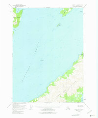
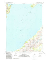
1951 Map of Seward A-2
USGS Topo · Published 1964About this map
Montague Strait dominates this maritime survey, serving as a deep-water passage between the northern reaches of Montague Island and the rugged southern tip of Knight Island. The topography reflects a landscape of dramatic coastal relief, where Horn Mountain rises sharply above the waters of Hogan Bay and Snug Harbor. This 1951 photogrammetric record captures the uninhabited character of the Chugach National Forest at mid-century, mapping critical navigational landmarks such as The Needle and Discovery Pt. The hydrographic data, compiled from USC&GS charts, provides detailed soundings through the main Channel and around the smaller landmasses of Green Island and Little Green Island. This specific configuration of the shoreline and seabed predates the significant tectonic shifts caused by the 1964 earthquake, making it a vital baseline for understanding the coastal evolution of this Prince William Sound corridor.
Find a feature on this map
14 named features on this map. Tap any name to fly to it.
Don’t see what you’re looking for? This feature index may not catch every label — zoom into the map to look around manually.
Map Details
Editions of this 1951 Seward A-2 Map
3 editions found
Other maps of this area

1946 · Blying Sound
USGS Topo · 1:250,000

1950 · Seward B-3
USGS Topo · 1:63,360

1951 · Blying Sound
USGS Topo · 1:250,000

1951 · Seward
USGS Topo · 1:250,000

1951 · Seward B-1
USGS Topo · 1:63,360

1951 · Seward A-3
USGS Topo · 1:63,360

1951 · Blying Sound D-1 and D-2
USGS Topo · 1:63,360

1951 · Seward A-1
USGS Topo · 1:63,360

1951 · Seward B-2
USGS Topo · 1:63,360

1952 · Seward B-1
USGS Topo · 1:63,360