
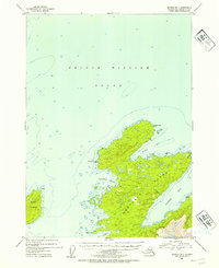
1952 Map of Seward B-1
USGS Topo · Published 1954About this map
Montague Island dominates the southeastern quadrant of this maritime study, showing the complex coastline of the Chugach National Forest in the early 1950s. The map illustrates the island's northern reaches, where the land meets the deep waters of Prince William Sound. Key navigational landmarks and protected waters such as Stockdale Harbor and Port Chalmers are detailed with depth soundings and topographic relief. These inlets provided critical shelter for vessels navigating the remote Alaskan waters of this era.
Find a feature on this map
12 named features on this map. Tap any name to fly to it.
Don’t see what you’re looking for? This feature index may not catch every label — zoom into the map to look around manually.
Map Details
Editions of this 1952 Seward B-1 Map
2 editions found
Other maps of this area

1948 · Cordova
USGS Topo · 1:250,000

1950 · Cordova C-8
USGS Topo · 1:63,360

1951 · Seward
USGS Topo · 1:250,000

1951 · Cordova
USGS Topo · 1:250,000

1951 · Seward B-1
USGS Topo · 1:63,360

1951 · Seward A-2
USGS Topo · 1:63,360

1951 · Seward A-1
USGS Topo · 1:63,360

1951 · Seward B-2
USGS Topo · 1:63,360

1951 · Seward C-1
USGS Topo · 1:63,360

1951 · Cordova B-8
USGS Topo · 1:63,360