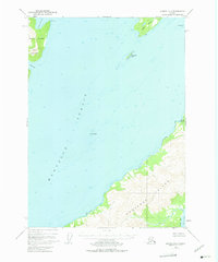
1951 Map of Seward A-2
USGS Topo · Published 1975About this map
Montague Island dominates the southeastern quadrant of this coastal survey, its interior topography rising sharply from the Gulf of Alaska. Across the wide expanse of Montague Strait, the map details the intricate coastlines of Knight Island and Green Island. This maritime landscape is defined by its deep inlets and rocky hazards, such as The Needle standing isolated in the strait. The presence of Snug Harbor and Hogan Bay along the northwestern shorelines suggests the vital role of sheltered waters for vessels navigating this portion of the Chugach National Forest. The map also captures the path of the Beach River as it cuts through the terrain of Montague Island, providing a detailed record of the hydrography and elevation before later seismic shifts in the region.
Find a feature on this map
13 named features on this map. Tap any name to fly to it.
Don’t see what you’re looking for? This feature index may not catch every label — zoom into the map to look around manually.
Map Details
Editions of this 1951 Seward A-2 Map
3 editions found
Other maps of this area

1946 · Blying Sound
USGS Topo · 1:250,000

1950 · Seward B-3
USGS Topo · 1:63,360

1951 · Blying Sound
USGS Topo · 1:250,000

1951 · Seward
USGS Topo · 1:250,000

1951 · Seward B-1
USGS Topo · 1:63,360

1951 · Seward A-2
USGS Topo · 1:63,360

1951 · Seward A-3
USGS Topo · 1:63,360

1951 · Blying Sound D-1 and D-2
USGS Topo · 1:63,360

1951 · Seward A-1
USGS Topo · 1:63,360

1951 · Seward B-2
USGS Topo · 1:63,360