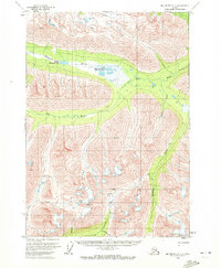
1959 Map of McCarthy A-7
USGS Topo · Published 1972About this map
Yellowband Mine and its nearby Aqueduct represent the industrial footprint of this remote Alaskan interior during the mid-20th century. High-altitude peaks like Azul and Verde look down over a complex drainage system where the Hanagita River connects Middle Hanagita Lake and the Upper Hanagita Lakes. The landscape is defined by its watercourses and early aviation infrastructure, notably the Bremner Landing Strip located near the confluence of Golconda Creek and Standard Creek.
Find a feature on this map
21 named features on this map. Tap any name to fly to it.
Don’t see what you’re looking for? This feature index may not catch every label — zoom into the map to look around manually.
Map Details
Editions of this 1959 McCarthy A-7 Map
2 editions found
Other maps of this area

1950 · McCarthy A-8
USGS Topo · 1:63,360

1950 · Bering Glacier
USGS Topo · 1:250,000

1951 · McCarthy
USGS Topo · 1:250,000

1951 · Bering Glacier
USGS Topo · 1:250,000

1951 · McCarthy B-8
USGS Topo · 1:63,360

1959 · McCarthy B-6
USGS Topo · 1:63,360

1959 · McCarthy A-6
USGS Topo · 1:63,360

1959 · Bering Glacier
USGS Topo · 1:250,000

1959 · McCarthy A-7
USGS Topo · 1:63,360

1959 · McCarthy B-7
USGS Topo · 1:63,360