
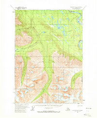
1959 Map of McCarthy A-6
USGS Topo · Published 1966About this map
Chitina River and its glacial tributaries define this Alaskan wilderness as it was documented in the late 1950s. The landscape is dominated by the confluence of the Chakina River and the Klu River, which flow northward through deep valleys toward the main river channel. Evidence of human presence is sparse and temporary, limited to scattered cabins and the Jake Bar Landing Strip along the riverbanks.
Find a feature on this map
14 named features on this map. Tap any name to fly to it.
Don’t see what you’re looking for? This feature index may not catch every label — zoom into the map to look around manually.
Map Details
Editions of this 1959 McCarthy A-6 Map
2 editions found
Other maps of this area

1950 · Bering Glacier
USGS Topo · 1:250,000

1951 · McCarthy
USGS Topo · 1:250,000

1951 · Bering Glacier
USGS Topo · 1:250,000

1959 · McCarthy B-6
USGS Topo · 1:63,360

1959 · McCarthy B-5
USGS Topo · 1:63,360

1959 · McCarthy A-5
USGS Topo · 1:63,360

1959 · Bering Glacier
USGS Topo · 1:250,000

1959 · McCarthy A-7
USGS Topo · 1:63,360

1959 · McCarthy B-7
USGS Topo · 1:63,360

1960 · McCarthy
USGS Topo · 1:250,000