
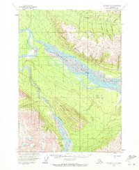
1959 Map of McCarthy A-5
USGS Topo · Published 1966About this map
The confluence of the Chitina River and the Tana River dominates this mid-century survey of the Alaskan interior. This glaciated landscape features the narrow Tana Canyon and the prominent heights of Mac Coll Ridge and Towhead Mountain. Human presence is minimal, marked primarily by the Tana River Landing Strip and isolated cabins that indicate the area's importance for bush pilots and seasonal trappers.
Find a feature on this map
23 named features on this map. Tap any name to fly to it.
Don’t see what you’re looking for? This feature index may not catch every label — zoom into the map to look around manually.
Map Details
Editions of this 1959 McCarthy A-5 Map
2 editions found
Other maps of this area

1950 · Bering Glacier
USGS Topo · 1:250,000

1951 · McCarthy
USGS Topo · 1:250,000

1951 · Bering Glacier
USGS Topo · 1:250,000

1959 · McCarthy B-6
USGS Topo · 1:63,360

1959 · McCarthy A-4
USGS Topo · 1:63,360

1959 · McCarthy B-5
USGS Topo · 1:63,360

1959 · McCarthy B-4
USGS Topo · 1:63,360

1959 · McCarthy A-6
USGS Topo · 1:63,360

1959 · Bering Glacier
USGS Topo · 1:250,000

1960 · McCarthy
USGS Topo · 1:250,000