
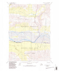
1959 Map of McCarthy A-4
USGS Topo · Published 1962About this map
The Chitina River dominates this mid-century landscape, carving a wide valley through the interior wilderness. Its braided waters surround significant landmarks like Bear Island and Bryson Bar, while numerous tributaries such as Discovery Creek and McCurdy Creek drain the surrounding elevations. To the north, the geography is defined by the sharp transition between the river bottom and the upland drainages of Young Creek and Sheep Creek.
Find a feature on this map
18 named features on this map. Tap any name to fly to it.
Don’t see what you’re looking for? This feature index may not catch every label — zoom into the map to look around manually.
Map Details
Editions of this 1959 McCarthy A-4 Map
2 editions found
Other maps of this area

1950 · Bering Glacier
USGS Topo · 1:250,000

1951 · McCarthy
USGS Topo · 1:250,000

1951 · Bering Glacier
USGS Topo · 1:250,000

1959 · McCarthy B-5
USGS Topo · 1:63,360

1959 · McCarthy B-4
USGS Topo · 1:63,360

1959 · McCarthy A-5
USGS Topo · 1:63,360

1959 · McCarthy A-3
USGS Topo · 1:63,360

1959 · Bering Glacier
USGS Topo · 1:250,000

1959 · McCarthy B-3
USGS Topo · 1:63,360

1960 · McCarthy
USGS Topo · 1:250,000