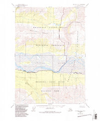
1959 Map of McCarthy A-4
USGS Topo · Published 1987About this map
The Chitina River dominates the center of this 1959 topographic record, carving a wide valley floor between the high elevations of Mac Coll Ridge and the glacier-fed tributaries to the south. This area, later incorporated into the Wrangell - Saint Elias National Park, is shown here in its mid-century state, defined by a complex drainage network that includes the Kiagna River and Discovery Creek. The map documents rare evidence of human presence in this wilderness, such as a lone Cabin near Big Bend Lakes and the named landing at Bryson Bar. Terrain features like Bear Island stand out within the braided river system, while the surrounding landscape is marked by steep canyons and named watercourses like Calamity Creek and Erickson Creek.
Find a feature on this map
27 named features on this map. Tap any name to fly to it.
Don’t see what you’re looking for? This feature index may not catch every label — zoom into the map to look around manually.
Map Details
Editions of this 1959 McCarthy A-4 Map
2 editions found
Other maps of this area

1950 · Bering Glacier
USGS Topo · 1:250,000

1951 · McCarthy
USGS Topo · 1:250,000

1951 · Bering Glacier
USGS Topo · 1:250,000

1959 · McCarthy A-4
USGS Topo · 1:63,360

1959 · McCarthy B-5
USGS Topo · 1:63,360

1959 · McCarthy B-4
USGS Topo · 1:63,360

1959 · McCarthy A-5
USGS Topo · 1:63,360

1959 · McCarthy A-3
USGS Topo · 1:63,360

1959 · Bering Glacier
USGS Topo · 1:250,000

1959 · McCarthy B-3
USGS Topo · 1:63,360