
1951 Map of McCarthy B-8
USGS Topo · Published 1964About this map
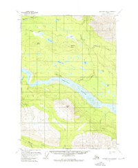
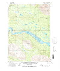
The Chetina River dominates this mid-century Alaskan landscape, its braided channels carving a wide path through the interior. To the north, evidence of early industrial infrastructure is visible in the long stretch of the Old Railroad Grade, which parallels the Kuskulana River and cuts past the Gilahina River. This corridor reflects the logistical challenges of resource extraction in the region, where rail lines were essential for moving materials across the complex network of tributaries and high ground. Isolated markers of human presence, such as a solitary Cabin near the upper railroad alignment, underscore the sparse settlement pattern characteristic of the territory during this era.
Find a feature on this map
19 named features on this map. Tap any name to fly to it.
Don’t see what you’re looking for? This feature index may not catch every label — zoom into the map to look around manually.
Map Details
Editions of this 1951 McCarthy B-8 Map
3 editions found
Other maps of this area

1950 · McCarthy A-8
USGS Topo · 1:63,360

1951 · McCarthy
USGS Topo · 1:250,000

1951 · Valdez B-1
USGS Topo · 1:63,360

1951 · Valdez A-1
USGS Topo · 1:63,360

1951 · McCarthy C-8
USGS Topo · 1:63,360

1951 · Valdez C-1
USGS Topo · 1:63,360

1952 · Valdez
USGS Topo · 1:250,000

1953 · Valdez C-1
USGS Topo · 1:63,360

1959 · McCarthy A-7
USGS Topo · 1:63,360

1959 · McCarthy C-7
USGS Topo · 1:63,360