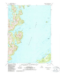
1951 Map of Seward B-2
USGS Topo · Published 1988About this map
Knight Island dominates the maritime landscape of Prince William Sound in this mid-century survey, its deeply indented shoreline forming complex waterways like the Bay of Isles and Snug Harbor. Evidence of mineral exploration appears in the interior, with several mines and a specific Mine located south of Marsha Bay. These industrial markers contrast with the sparse settlement patterns, where only scattered Cabins are noted along the northern shore of Green Island.
Find a feature on this map
37 named features on this map. Tap any name to fly to it.
Don’t see what you’re looking for? This feature index may not catch every label — zoom into the map to look around manually.
Map Details
Editions of this 1951 Seward B-2 Map
4 editions found
Other maps of this area

1950 · Seward B-3
USGS Topo · 1:63,360

1951 · Seward
USGS Topo · 1:250,000

1951 · Seward B-1
USGS Topo · 1:63,360

1951 · Seward A-2
USGS Topo · 1:63,360

1951 · Seward A-3
USGS Topo · 1:63,360

1951 · Seward A-1
USGS Topo · 1:63,360

1951 · Seward B-2
USGS Topo · 1:63,360

1951 · Seward C-1
USGS Topo · 1:63,360

1951 · Seward C-3
USGS Topo · 1:63,360

1951 · Seward C-2
USGS Topo · 1:63,360