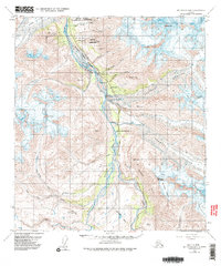
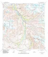
1954 Map of Mt. Hayes B-4
USGS Topo · Published 1985About this map
Delta River carved valleys dominate this interior Alaskan landscape, where the Richardson Highway provides the primary corridor for movement and infrastructure. This mid-century topography reveals the juxtaposition of natural glacial systems and human engineering, evidenced by the path of the Trans-Alaska Pipeline and the presence of Pump Sta 10. Settlements are sparse and functional, centered around locations like Trims Camp and the historic Millers Roadhouse, which served travelers and workers in this demanding environment.
Find a feature on this map
33 named features on this map. Tap any name to fly to it.
Don’t see what you’re looking for? This feature index may not catch every label — zoom into the map to look around manually.
Map Details
Editions of this 1954 Mt. Hayes B-4 Map
6 editions found

Other maps of this area

1949 · Mount Hayes A-4
USGS Topo · 1:63,360

1949 · Mount Hayes A-5
USGS Topo · 1:63,360

1950 · Mount Hayes
USGS Topo · 1:250,000

1950 · Mount Hayes C-4
USGS Topo · 1:63,360

1950 · Mount Hayes A-3
USGS Topo · 1:63,360

1951 · Mount Hayes
USGS Topo · 1:250,000

1951 · Mount Hayes C-5
USGS Topo · 1:63,360

1951 · Mt. Hayes B-5
USGS Topo · 1:63,360

1952 · Mount Hayes A-3
USGS Topo · 1:63,360

1952 · Mount Hayes A-4
USGS Topo · 1:63,360