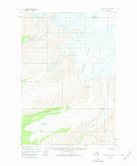
1959 Map of Valdez D-1
USGS Topo · Published 1975About this map
Mt Wrangell Crater dominates the northern reaches of this glacial landscape, a high-altitude terrain defined by massive ice flows and the drainages they feed. Large glacial systems including the Chetaslina Glacier, Cheshnina Glacier, and the expansive Long Glacier carve through the high country, revealing the slow geological transformation of the Copper River region during the late 1950s. These ice fields give rise to a network of active waterways like the Chetaslina River and the Cheshnina River, which is notably marked by Cheshnina Falls.
Find a feature on this map
11 named features on this map. Tap any name to fly to it.
Don’t see what you’re looking for? This feature index may not catch every label — zoom into the map to look around manually.
Map Details
Editions of this 1959 Valdez D-1 Map
2 editions found

Other maps of this area

1950 · Nabesna
USGS Topo · 1:250,000

1951 · McCarthy
USGS Topo · 1:250,000

1951 · Gulkana
USGS Topo · 1:250,000

1951 · Nabesna
USGS Topo · 1:250,000

1951 · McCarthy C-8
USGS Topo · 1:63,360

1951 · Valdez C-2
USGS Topo · 1:63,360

1951 · Valdez C-1
USGS Topo · 1:63,360

1952 · Valdez
USGS Topo · 1:250,000

1953 · Valdez C-2
USGS Topo · 1:63,360

1953 · Valdez C-1
USGS Topo · 1:63,360