
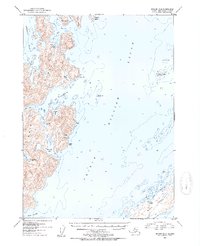
1952 Map of Seward B-2
USGS Topo · Published 1954About this map
Knight Island and Green Island dominate this coastal survey of the western reach of Prince William Sound. The map reveals a landscape defined by deep fjords and maritime navigation, featuring numerous natural harbors such as Snug Harbor and the Bay of Isles. On the eastern shore of Knight Island, a specific point of industrial history is noted at Mins (Aban'd) near Rua Cove, suggesting earlier mineral exploration within the Chugach National Forest. Small clusters of Cabins and tidal benchmarks like BM (Tidal) are scattered along the rugged shoreline, providing evidence of temporary settlements and hydrographic survey points. The intricate waterways, including Lower Passage and the West Arm of the bay, indicate the complex coastal geography that guided early 20th-century vessel traffic through the sound.
Find a feature on this map
34 named features on this map. Tap any name to fly to it.
Don’t see what you’re looking for? This feature index may not catch every label — zoom into the map to look around manually.
Map Details
Editions of this 1952 Seward B-2 Map
2 editions found
Other maps of this area

1950 · Seward B-3
USGS Topo · 1:63,360

1951 · Seward
USGS Topo · 1:250,000

1951 · Seward B-1
USGS Topo · 1:63,360

1951 · Seward A-2
USGS Topo · 1:63,360

1951 · Seward A-3
USGS Topo · 1:63,360

1951 · Seward A-1
USGS Topo · 1:63,360

1951 · Seward B-2
USGS Topo · 1:63,360

1951 · Seward C-1
USGS Topo · 1:63,360

1951 · Seward C-3
USGS Topo · 1:63,360

1951 · Seward C-2
USGS Topo · 1:63,360