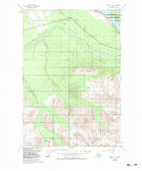
1951 Map of Valdez C-3
USGS Topo · Published 1984About this map
The Wrangell-Saint Elias National Preserve dominates the northeastern corner of this 1951 aerial survey, where the glacial silt-laden waters of the Copper River flow south. The landscape is defined by the sharp transition from the broad, lake-potted lowlands near Kenney Lake to the high alpine reaches of Kimball Pass. The Edgerton Highway serves as the primary artery for the region, cutting through the northern section and providing access to the Tonsina River valley.
Find a feature on this map
10 named features on this map. Tap any name to fly to it.
Don’t see what you’re looking for? This feature index may not catch every label — zoom into the map to look around manually.
Map Details
Editions of this 1951 Valdez C-3 Map
3 editions found
Other maps of this area

1949 · Valdez D-4
USGS Topo · 1:63,360

1951 · Valdez B-2
USGS Topo · 1:63,360

1951 · Valdez B-3
USGS Topo · 1:63,360

1951 · Valdez C-2
USGS Topo · 1:63,360

1951 · Valdez C-3
USGS Topo · 1:63,360

1951 · Valdez C-4
USGS Topo · 1:63,360

1951 · Valdez B-4
USGS Topo · 1:63,360

1952 · Valdez
USGS Topo · 1:250,000

1952 · Valdez D-4
USGS Topo · 1:63,360

1953 · Valdez C-2
USGS Topo · 1:63,360