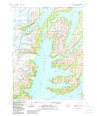
1951 Map of Seward A-4
USGS Topo · Published 1988About this map
Massive tidewater ice and intricate coastal waterways dominate this part of the Chugach National Forest as it appeared in the mid-20th century. The landscape is defined by the convergence of several major ice fields, most notably the Chenega Glacier and Tigertail Glacier, which feed into the deep waters of Nassau Fiord and Icy Bay. Further south, the Bainbridge Glacier reaches toward the narrow marine corridors that weave through the archipelago.
Find a feature on this map
31 named features on this map. Tap any name to fly to it.
Don’t see what you’re looking for? This feature index may not catch every label — zoom into the map to look around manually.
Map Details
Editions of this 1951 Seward A-4 Map
3 editions found

Other maps of this area

1946 · Blying Sound
USGS Topo · 1:250,000

1950 · Seward B-3
USGS Topo · 1:63,360

1950 · Blying Sound D-4
USGS Topo · 1:63,360

1950 · Blying Sound D-5
USGS Topo · 1:63,360

1951 · Blying Sound
USGS Topo · 1:250,000

1951 · Seward
USGS Topo · 1:250,000

1951 · Seward B-4
USGS Topo · 1:63,360

1951 · Seward A-5
USGS Topo · 1:63,360

1951 · Seward A-3
USGS Topo · 1:63,360

1951 · Seward B-5
USGS Topo · 1:63,360